
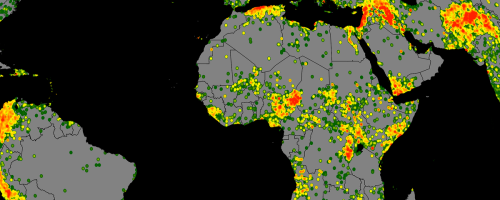
Nedshield has converted various global datasets into a service API providing GeoJSON feeds. These feeds are designed to enhance the situational awareness and context of various projects including drone surveys and camp design models.
| CLIMATE & GEOGRAPHY | HAZARDS | LOGISTICS & SECURITY |
| Global Temperature |
Global Natural Disaster Database Set |
Gridded Population of the World |
| Global Precipitation | Global Cyclone Hazard Frequency and Distribution |
OpenRailwayMap (global) |
| Global Solar Radiation | Global Drought Hazard Frequency and Distribution |
The World Port Index |
| Global Average Wind Speed ( standard 50m) | Global Earthquake Hazard Frequency and Distribution |
Shipping Lanes |
| Global Lakes and Wetlands Database | Global Seismic Hazard Assessment |
Global Airports (in dev) |
| Soil Geographic Databases | Global Flood Hazard Frequency and Distribution |
Air Flight Paths (in dev) |
| Soil Geographic Databases | Global Landslide Hazard Distribution |
Global Hospital Database |
| Global Land Use Dataset | Global Volcano Hazard Frequency and Distribution |
Global Terrorism Database (GTD) |
| Global Multihazard Frequency and Distribution |
Armed Conflict Location and Event Data |
|
| Global Database on Violence against Women (in dev) |
Contact us to get more information.